Knotbury Common, Three Shires Head, Danethorn Hollow, Danebower Hollow, Dane Valley Way
2 Hrs 17 mins
5.44 miles (8.75 Km)
COVID-19 update. Parking in the area is currently very restricted. There is a small layby on the left on the lane down from the A53. Grid ref at SK022682. I will update the website if the situaton changes.
SK018682
From the layby, walk downhill passing the 1st turn right then take the 2nd right turn.
Head uphill passing the 2 houses on your left.
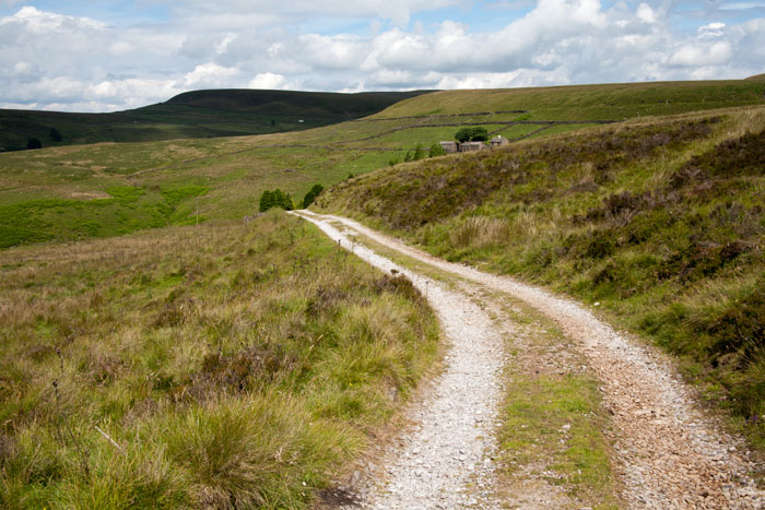
Take the farm track on right above Knotbury farm, just before the sign “Narrow road no turning area…….”
Follow this over moorland, passing farm on left and down to stream.
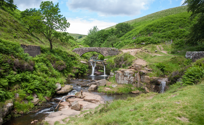
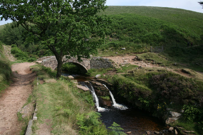
Immediately over stream turn left and follow the path with stream on your left down to Panniers Pool at Three Shires Head.
Over the bridge turn right and follow upstream to where the path forks by a small stream/bridge.
Take left fork which is straight on through gate (not right over stile).
With wall on your right, follow the signs around the farm.
Note: Where arrow points left uphill towards the A54, there are 2 choices:-
1) If you have a dog, it may find the very steep high metal grilled steps leading up to the A54 very difficult. In which case don’t turn left uphill but go through 3 metal gates which will bring you to the tarmac farm road. Turn left here up to the A54, then turn left and take the track on right opposite the 2nd set of metal steps on your left.
2) If the steps aren’t an issue, turn left uphill keeping the wall on your right (avoid the gap in the wall part way up) to the stile over the wall on your right. Then up to the metal steps to the A54.
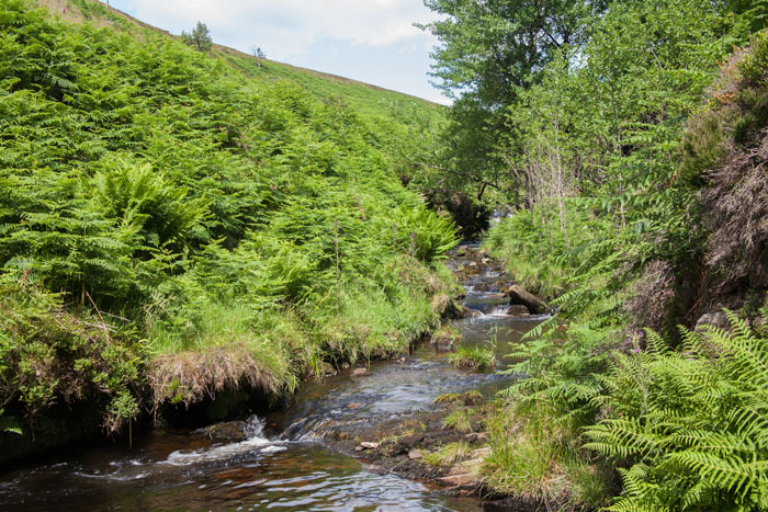
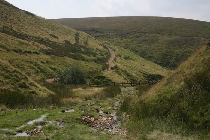
Straight over A54, through gate onto track and follow to stream & waterfall.
Immediately after stream turn right and follow path uphill by stream.
At top where you meet a “T” junction of paths, turn right, signposted “Three Shires Head”.
Straight over at A54 and down to “T” junction of paths where you turn left.
Follow path past the disused quarries and over stream.
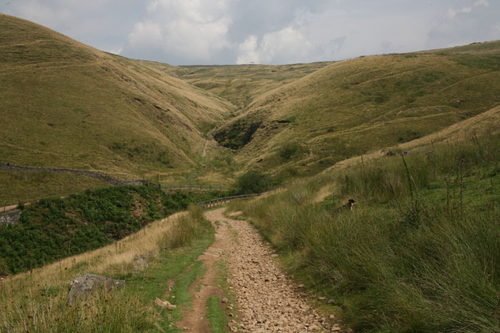
Follow well defined path (avoiding path through metal gate on right), maintaining approximately the same height to reach a metal gate at the head of a deep gorge (end of open access sign).
Through gate and continue on path to farm track.
Turn right at farm track heading downhill.
As farm track doubles back on itself, head directly downhill on feint path keeping the wall on your left (a lot of nettles in this area but there’s normally a gap between wall on your left and the nettles).
When wall on left ends, bear left and head down to road.
Turn left on road for 100 mtrs to where wall on your right ends, then turn right uphill.
At crest of hill, take gate on right and follow the path with remains of a wall on your left to a large wooden stile.
Over stile and turn left onto track and back to car.


Site by Ged